Key Differences in Data Collection Methods
When it comes to drone surveying, two big players dominate the field: LiDAR and photogrammetry. Both methods have their unique strengths and limitations, but understanding the key differences between them can help you choose the right tool for your project. Let’s dive into the nitty-gritty in the most fun and digestible way possible!
LiDAR: Lasers That Never Miss a Beat
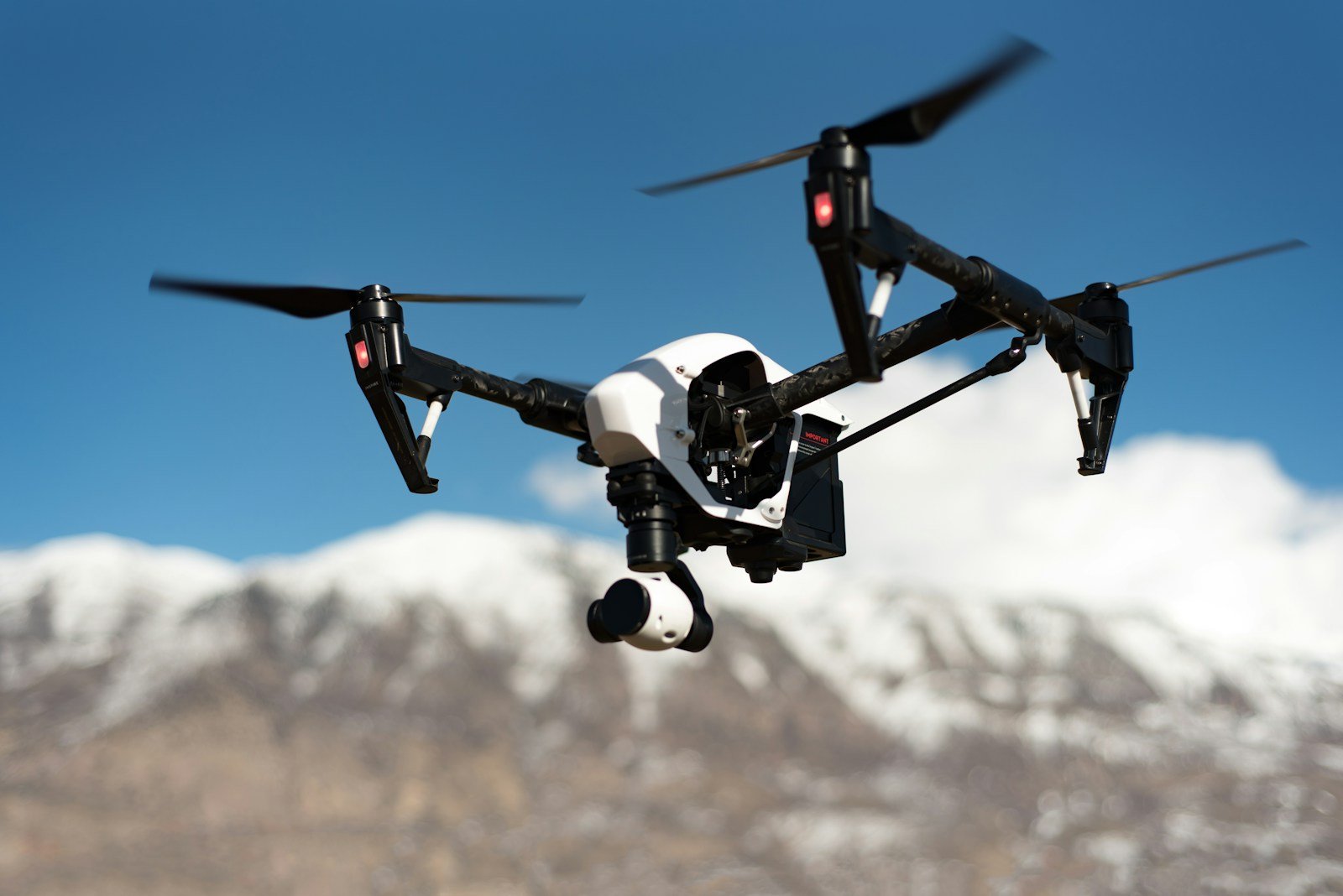
LiDAR, short for Light Detection and Ranging, uses laser pulses to collect data. Imagine thousands of tiny lasers bouncing off surfaces and returning to the drone, all while capturing precise measurements. This method is incredibly effective in areas covered by vegetation or where terrain is uneven. Ever wondered how surveyors map dense forests? That’s where LiDAR swoops in to save the day!
With LiDAR, you’re getting highly accurate elevation data, even in areas that photogrammetry might struggle with. It’s like having X-ray vision for the ground beneath dense tree canopies. This precision makes it a go-to for industries like forestry, mining, and flood modeling. However, the equipment isn’t exactly light on your wallet. Investing in LiDAR technology might feel like buying a luxury car—worth it, but only if you really need it!
Photogrammetry: Turning Pictures into Magic
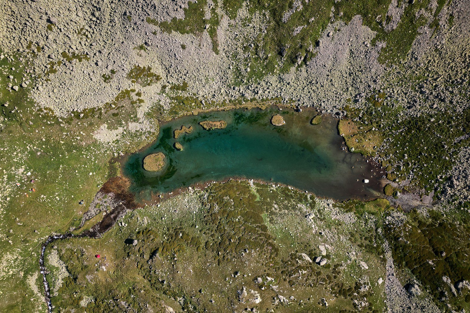
On the other hand, photogrammetry relies on photographs to map an area. It works by capturing overlapping images from different angles and stitching them together to create a 3D model. Think of it as a giant jigsaw puzzle where the drone does all the hard work.
Photogrammetry is fantastic for creating visually stunning maps and models. If you’re in real estate or construction, you’ll love the detailed, colorful outputs that showcase properties and projects in all their glory. But there’s a catch—this method needs clear visibility. Photogrammetry struggles with dense vegetation or shadowy spots, where it can’t quite “see” what’s underneath.
Despite this limitation, it’s much more affordable compared to LiDAR. Plus, if you already have a high-quality drone and a decent camera, you’re halfway there! Just don’t forget the software—it’s the magical ingredient that turns those photos into a 3D masterpiece.
When to Choose LiDAR Over Photogrammetry

Choosing between LiDAR and photogrammetry boils down to the project’s needs. Is your site covered in thick vegetation, or does it have uneven terrain? Then LiDAR is your hero. It penetrates vegetation, collects precise elevation data, and shines in conditions that would leave photogrammetry scratching its head.
LiDAR also works wonders in large-scale projects where high accuracy is non-negotiable. Imagine mapping a sprawling forest for an environmental study or measuring flood plains for urban planning. These are tasks that demand the unmatched precision of LiDAR. But let’s be real—it’s not your everyday tool. If you’re just starting in drone surveying, it might feel a bit like overkill.
When Photogrammetry Gets the Spotlight
Now, if you’re mapping a clear, open area with no dense foliage or extreme elevation changes, photogrammetry might be your best bet. It’s the MVP for industries like real estate, where aesthetic appeal is just as important as accuracy. From showcasing a new construction project to surveying farmland, photogrammetry delivers stunning visuals at a fraction of LiDAR’s cost.
Another great thing about photogrammetry is its user-friendly nature. You don’t need a high-tech setup to get started. A decent drone, a good camera, and photogrammetry software are enough to kick off your journey. It’s like the Swiss Army knife of drone mapping—versatile, reliable, and perfect for everyday use.
Accuracy vs. Affordability: Striking the Balance
The real trick is knowing when to prioritize accuracy and when to focus on cost-effectiveness. If your project absolutely requires pinpoint precision, such as in civil engineering or archaeology, LiDAR is the clear winner. However, if you’re working on a budget and need visually appealing results, photogrammetry is more than capable of getting the job done.
Remember, there’s no one-size-fits-all solution in drone surveying. The method you choose should align with your project’s goals, budget, and the terrain you’re working with. Think of LiDAR and photogrammetry as tools in a toolbox—each one has its purpose, and knowing when to use them is key to nailing your project.
Best Use Cases for Each Technology
When it comes to drone surveying, LiDAR and photogrammetry each bring unique advantages to the table. But figuring out which one suits your project can feel like choosing between a fancy Swiss watch and a reliable digital one—both are amazing, but their strengths shine in different situations. Let’s break down the best use cases for each technology to help you make a confident choice.
LiDAR: Tackling the Toughest Terrain
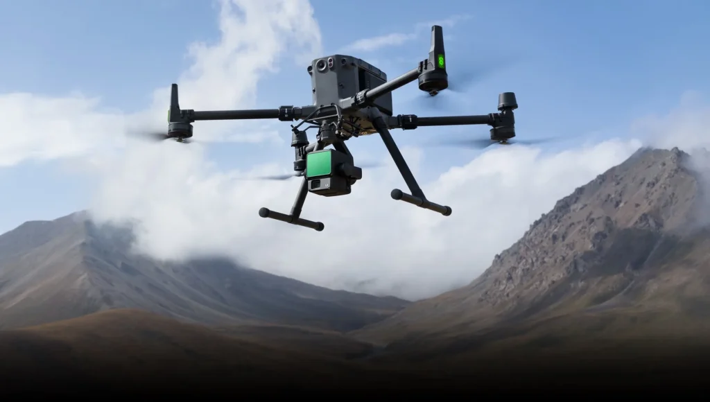
If your project involves dense vegetation or challenging landscapes, LiDAR is your ultimate sidekick. Imagine trying to map a rainforest—sounds tricky, right? Photogrammetry might struggle to see past the thick tree canopies, but LiDAR swoops in like a superhero. Its laser pulses cut through leaves and branches, giving you precise data about the ground below.
LiDAR is also a game-changer for projects where every millimeter matters. Think of construction sites, floodplain modeling, or even archaeological digs. When you need elevation data that’s spot-on accurate, LiDAR has your back. For example, city planners often use it to design drainage systems or analyze potential flood zones. It’s the kind of precision you’d want if you were building a bridge or preserving ancient ruins.
Another cool thing about LiDAR? It works beautifully at night. Since it doesn’t rely on sunlight, you can map areas even under the cover of darkness. This makes it perfect for projects with tight deadlines or where night mapping is the only viable option.
Photogrammetry: Making the World Picture-Perfect
Photogrammetry, on the other hand, shines when you need stunning visuals and easy-to-use technology. Imagine a real estate agent showing off a property with a colorful, detailed 3D map—photogrammetry is the tool for the job. Its ability to capture vibrant, high-resolution images makes it perfect for industries where presentation is key.
Agriculture is another field where photogrammetry works wonders. By using drones to create detailed maps of farmland, you can identify crop health, detect irrigation issues, and even optimize planting patterns. It’s like giving farmers a bird’s-eye view of their land, helping them make smarter decisions without breaking the bank.
Construction sites also benefit from photogrammetry, especially during progress monitoring. Want to show stakeholders how much work has been completed? A 3D model from photogrammetry makes it easy to visualize and communicate progress. It’s a practical, budget-friendly way to keep everyone in the loop while documenting milestones.
LiDAR: Best for Precision and Specialized Projects
To sum it up, LiDAR is your go-to for:
- Forestry and Environmental Studies: Mapping dense forests or studying ecosystems without disturbing the environment.
- Floodplain and Terrain Analysis: Gathering accurate elevation data for flood risk assessment and urban planning.
- Archaeological Research: Discovering hidden ruins or ancient structures beneath overgrown vegetation.
- Utility Mapping: Surveying power lines, pipelines, and other infrastructure with unparalleled accuracy.
It’s like having a laser-focused tool for the trickiest tasks.
Photogrammetry: Best for Visual Appeal and Versatility
Meanwhile, photogrammetry is ideal for:
- Real Estate Marketing: Showcasing properties with eye-catching 3D models and maps.
- Agriculture: Helping farmers monitor crops, identify issues, and boost yields.
- Construction Projects: Documenting site progress with stunning, easy-to-interpret visuals.
- Tourism and Heritage Sites: Creating immersive 3D models of landmarks and attractions for virtual tours.
Think of it as your go-to for visually engaging and budget-friendly mapping needs.
Cost Implications of LiDAR and Photogrammetry
When you’re diving into the world of drone surveying, one of the most important factors to consider is cost. Both LiDAR and photogrammetry have their strengths, but they come with very different price tags. Understanding the cost implications of each can help you make a decision that’s best for your budget and project needs. Let’s break it down in a fun, easy-to-understand way!
LiDAR: The Premium Choice
LiDAR is often considered the high-end option when it comes to drone surveying. Why? Because of the technology involved and the level of precision it delivers. The equipment needed for LiDAR is more expensive, and that’s not even considering the need for specialized software and data processing tools. Think of LiDAR like buying a luxury car—it’s an investment, but you’re getting top-notch performance in return.
The cost of a LiDAR-equipped drone alone can be a hefty sum. If you factor in the software for processing the data, the overall investment can quickly rise. But don’t let that scare you off! This precision technology is unmatched when it comes to mapping challenging terrains like dense forests, rocky landscapes, and flood-prone areas.
Another hidden cost with LiDAR is the need for skilled operators. Operating a LiDAR system requires specific training, and hiring qualified professionals adds another layer to the price tag. Plus, the data collected through LiDAR needs time to process, which can incur additional costs depending on the size and complexity of the project.
However, LiDAR’s ability to provide incredibly accurate and detailed data makes it worth the investment for industries that require high-level precision. If you’re involved in engineering, mining, or environmental studies, the cost of LiDAR may be justified by the quality and reliability of the results.
Photogrammetry: Affordable Yet Effective
Now, let’s talk about photogrammetry. While it doesn’t offer the same level of precision as LiDAR, it certainly makes up for it in terms of affordability and versatility. Photogrammetry uses cameras to capture images and create 3D models, so the equipment required is generally much less expensive.
Not only is the initial investment lower, but photogrammetry also has less of a learning curve. You won’t need to invest in expensive training for operators, and the software for processing the images is often less costly and easier to use. Many photogrammetry software programs offer free or affordable versions for beginners, which is great if you’re just starting out.
For many industries, photogrammetry’s affordability makes it a perfect option. Real estate agents, for example, love it for showcasing properties without breaking the bank. Similarly, farmers can use it to monitor crops and analyze farmland without the hefty cost of LiDAR. While the accuracy may not be as high as with LiDAR, photogrammetry still provides a solid, reliable alternative for less complex surveying tasks.
Which One Gives You More Bang for Your Buck?
So, how do you decide which technology is the best investment for your project? Well, it depends on what you’re looking to accomplish and how much you’re willing to spend. If your goal is to create visually stunning 3D models or maps for marketing purposes, photogrammetry is a more affordable and effective choice. It’s perfect for real estate agents, small construction businesses, or anyone who needs to showcase their work with great visuals without needing precise elevation data.
On the other hand, if you’re working on a project that demands high accuracy and can’t afford to make any compromises, LiDAR is worth the splurge. This is especially true for large-scale or technical projects where precise measurements are critical. Think of flood modeling, topographic surveys, or environmental assessments—LiDAR will give you the detailed data needed to make informed decisions.
In short, the decision comes down to your needs. Photogrammetry might be the best choice for smaller projects or when visuals matter more than absolute precision. LiDAR, however, is ideal when you need detailed, reliable data in tough environments. The choice is all about striking the balance between what you’re willing to spend and what you require from your survey.
Hidden Costs You Might Not Expect
While it’s easy to focus on the initial investment, there are a few hidden costs you should keep in mind. For both LiDAR and photogrammetry, processing the collected data takes time and resources. Even after you’ve captured your images or laser scans, you’ll need software and computing power to turn that raw data into something usable. High-quality data processing can incur significant costs, especially for larger projects.
Additionally, for LiDAR, maintenance and calibration are ongoing costs. Since the technology is so precise, it requires regular care to ensure accuracy. Photogrammetry, while generally less expensive in this regard, still needs quality control to ensure your models are accurate, especially if you’re working on large or complex surveys.
There’s also the cost of flying permits, depending on your location and the type of survey you’re conducting. LiDAR surveys, for instance, often require special permissions due to the complex equipment used and the specific regulations surrounding aerial surveys. Photogrammetry, on the other hand, generally has fewer restrictions but still requires a good understanding of airspace rules.
Combining Technologies for Enhanced Results
In the world of drone surveying, two powerful technologies—LiDAR and photogrammetry—stand out for their unique strengths. While each has its own set of benefits, combining these technologies can take your surveying projects to the next level. By using both LiDAR and photogrammetry together, you can harness the best of both worlds—precise data and visually stunning models. Let’s explore how combining these technologies can lead to enhanced results that’ll leave you wowed!
The Power of Complementary Strengths

LiDAR and photogrammetry might seem like two completely different tools, but they complement each other in some pretty amazing ways. LiDAR excels in capturing detailed elevation data, even in tough conditions like dense forests or rugged terrain. It’s fantastic for tasks that require precision, such as mapping floodplains or topographic surveys. However, when it comes to creating high-quality, visually appealing models, photogrammetry is the hero.
Photogrammetry takes over when you need to generate 3D models that are rich in color and texture. It’s great for industries like real estate or construction, where visuals matter just as much as data. But, while photogrammetry is great at capturing the visual details, it lacks the precision of LiDAR when it comes to elevation changes and topography. That’s where combining these two technologies comes in.
Imagine you’re surveying a hilly area with both open fields and a forest. LiDAR will accurately capture the terrain, including the ground beneath the trees, while photogrammetry will create a colorful, detailed model of the open spaces. Together, they’ll give you the most accurate, aesthetically pleasing result. By combining them, you get the best of both precision and visual appeal—making your project both reliable and beautiful!
How the Combination Works in Practice
When you combine LiDAR and photogrammetry, the process typically involves capturing data from both technologies during the same flight. You’ll use the LiDAR system to collect precise measurements, such as elevation data, and simultaneously capture high-resolution photos for photogrammetry. After the flight, the real magic happens in the software.
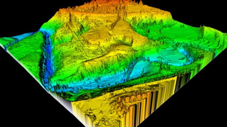
The LiDAR data gives you a solid foundation of precise 3D points, creating a detailed digital elevation model (DEM). This allows you to accurately map the landscape, even in areas with dense vegetation or complex terrain. Then, photogrammetry takes those photos and uses them to generate a realistic, textured 3D model. The result? You get both an accurate map and a visually engaging model that shows off the site in full color.
This combined approach is especially beneficial in industries like construction, urban planning, or environmental studies. For instance, if you’re working on a construction project, the combination of LiDAR’s accuracy with photogrammetry’s visuals helps stakeholders better understand the site. They can see the precise measurements and also visualize the area, making project planning easier and more effective.
Real-World Examples of the Power Combo

Let’s take a look at a few real-world examples where combining LiDAR and photogrammetry really shines.
- Land Development Projects: Imagine you’re planning to build a new residential community. Using LiDAR, you can accurately map the terrain, taking into account elevation changes, slopes, and flood risk. At the same time, photogrammetry captures the visual details of the land, creating a 3D model that helps visualize where roads, buildings, and parks will go. By combining both, you get a precise map that helps you plan and design the land efficiently while providing clear visuals for presentations.
- Historical Site Preservation: Archaeologists and historians love this combo! LiDAR can be used to uncover hidden structures or ruins beneath dense vegetation, while photogrammetry can create a highly detailed 3D model of the site. This allows preservationists to document the site for future study and protection. Combining both technologies enables a comprehensive approach to preserving cultural heritage, offering accurate measurements and detailed visuals in one package.
- Flood Risk Mapping: When assessing flood risks for urban planning or disaster preparedness, both LiDAR and photogrammetry play a vital role. LiDAR creates a highly detailed digital elevation model of the landscape, identifying areas at risk of flooding. Photogrammetry provides visual context, helping city planners to visualize flood-prone areas in a way that’s easy to understand. Together, they form a complete picture that’s both accurate and accessible, helping officials make informed decisions about flood management.
Maximizing Efficiency and Accuracy
One of the key benefits of combining LiDAR and photogrammetry is the boost in efficiency and accuracy. Instead of relying on just one technology and possibly missing key details, you get the best of both worlds. LiDAR provides accurate elevation and distance data, while photogrammetry fills in the gaps with stunning visuals and texture.
Additionally, this combined approach can speed up the survey process. Since the data is collected simultaneously, you don’t have to make multiple passes over the site. This saves both time and money, making the surveying process more efficient without sacrificing accuracy.
By integrating both technologies, you’re also minimizing the chances of errors or gaps in the data. LiDAR excels at capturing fine details, but sometimes it can miss the visual context that photogrammetry provides. Similarly, while photogrammetry is great for textures and details, it can struggle with complex terrain. By using both technologies together, you get a more complete and accurate dataset, which ultimately leads to better results.
Final Thoughts: Two Technologies, One Powerful Solution
In the world of drone surveying, combining LiDAR and photogrammetry can unlock a whole new level of possibilities. Whether you’re in construction, real estate, archaeology, or environmental studies, this dynamic duo has the potential to make your projects more accurate, more efficient, and visually stunning.
By capturing the precision of LiDAR and the visual richness of photogrammetry, you can create comprehensive models that are both reliable and easy to understand. So, next time you’re planning a surveying project, consider using both technologies for enhanced results. With LiDAR’s accuracy and photogrammetry’s beauty, you’ll have the ultimate combination to tackle any challenge that comes your way!